


MapPad GPS Land Surveys

Описание на MapPad GPS Land Surveys
Използвайте MapPad, за да изчислите площи, периметри и разстояния и да запишете, експортирате или споделите вашите измервания.
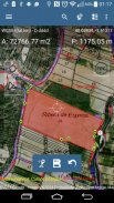
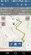
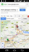
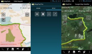
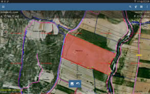
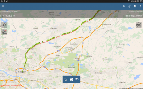
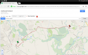
MapPad предлага многофункционално картографиране, позволяващо улавяне на местоположението и определя разстоянието и площта за фигурите, изчертани на картата или заснети, като се използва GPS проследяване в реално време.
Изчислете незабавно площта на полето или разстояние пеша, като използвате Google или Bing Map Satellite изглед. Спестете бензин и време и заснемете функции с няколко кликвания върху картата.
С MapPad можете лесно да улавяте, управлявате и споделяте данните си.
MapPad е много полезен инструмент за всеки, който се занимава с горско стопанство, селско стопанство, инженеринг и управление на недвижими имоти.
Моля, посетете нашия уебсайт, за да разберете как да подготвите офлайн карта и да получите повече информация за този продукт.
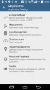
Избрани функции:
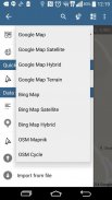
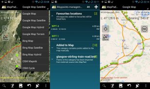
- Основни карти: Google Maps, Open Street Map, Bing Maps
- наслагвания на Google Maps (персонализирана WMS или ArcGIS сървър с керемиди), някои слоеве като топографска карта на САЩ са предварително дефинирани.
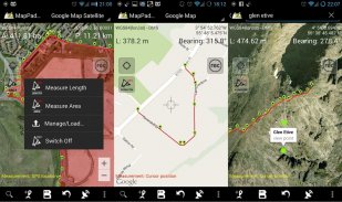
- Много точно измерване на площи и разстояния.
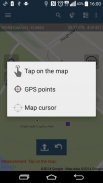
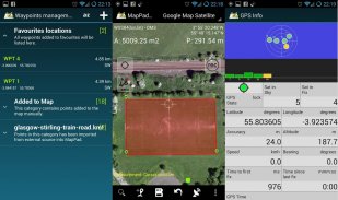
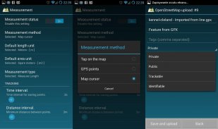
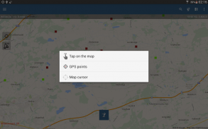
- Поддържат се 3 метода за измерване (Докоснете картата, местоположението на GPS, местоположението на курсора на картата).
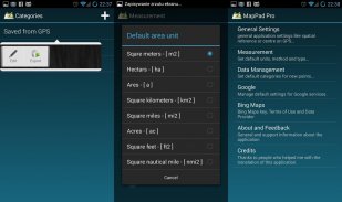
- Подкрепа за брой метрични и имперски единици.
- Поддръжка за няколко глобални и локални координатни системи, ако се нуждаете от поддръжка за която и да е друга пространствена референция, моля свържете се.
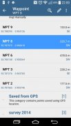
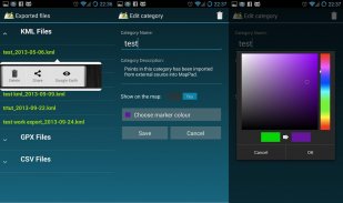
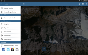
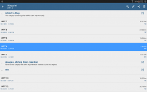
- Възможност за заснемане на пътни точки и групирането им по категории.
- Възможност за добавяне или редактиране на заглавие и описание за всяко записано измерване и точка.
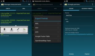
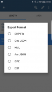
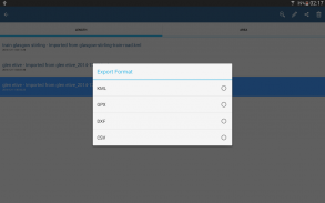
- Експортирайте единични или множество измервания или точки в SHP файл, Geojson, ArcGIS Json, KML, GPX, CSV и DXF на SD карта или облачни услуги, както и директен експорт към Open Street Map.
- Споделете директно местоположението на една точка, чрез SMS, имейл или други начини.
- Наличен профил за кота за измервания, извършени чрез GPS.
- Импортиране на KML и GPX файлове в приложението.
- Статус на GPS и сателити.
- Адрес, търсене на местоположение.
- Бързо отворени експортирани KML файлове в Google Earth
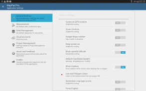
- Възможност за задаване на мерни единици за измерване по подразбиране, цветове на категориите за пътни точки, време за запис и интервал на разстояние, прозрачност на наслагвания на Google Maps и много други ...
Нашите потребители успешно използват MapPad в редица проекти и приложения.
MapPad GPS Land Surveys - Version 7.5.0
(19-05-2019)
MapPad GPS Land Surveys - APK информация
APK версия: 7.5.0Пакет: com.osedok.mappadLatest Version of MapPad GPS Land Surveys
Други версии


Apps in the same category

You may also like...


